
This afternoon in Missoula, Montana, I’ve enjoyed taking a Google Earth workshop with Jeff Crews. (This is Jeff’s intro Google Preso for our workshop, I’ll post more notes from his session soon.) Jeff showed us all kinds of layers and KML/KMZ files which can be viewed in Google Earth, including this layer of historical tornado tracks in the United States. I used Google Earth to view historical tornado tracks in north Oklahoma City / The Village where we live now east of Lake Hefner.
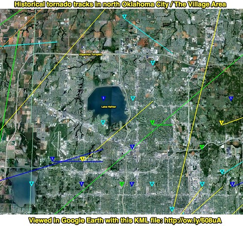
This screenshot was captured and annotated with Skitch in Google Earth. We didn’t doubt this as a family, but this is certainly more visual proof we live in tornado alley!