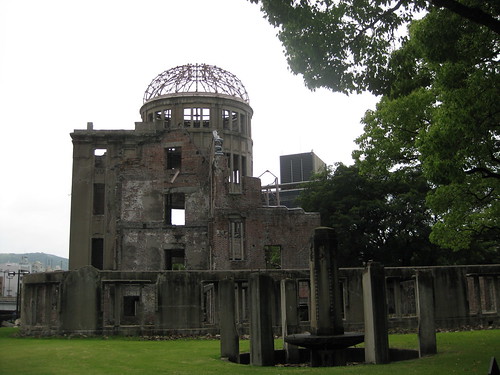
My 8th grade daughter asked me over the weekend if I had any ideas for a project she could do in her English class related to John Hersey’s book, “Hiroshima,” which her class just finished reading. My first thought was a GeoMap project, which would overlay statistics about the numbers of Japanese and U.S. soldiers killed in the battles leading up to the dropping of the atomic bombs in August 1945 on Hiroshima and Nagasaki, as well as the number of Japanese killed when both bombs were dropped. One of the big things I remember from my own “post-bac” teacher education program in the mid 1990s at Texas Tech was the book “Sadako and the Thousand Paper Cranes,” and the way our professor presented this episode of history without any context looking at the events which led up to the dropping of the atom bombs. Her approach, as I recall, was to unequivocally condemn Harry Truman, and ignore other issues which led to this momentous and costly decision.
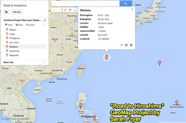
Sarah ended up creating an interactive Geo-Map on a Chromebook using Google’s Map Engine Lite website, which she titled “Road to Hiroshima.” I helped her create a Google Spreadsheet of her data, using original research we collaborated on together in a Google Doc. The Google Doc also includes links to the websites we used for our research, which started with the PBS “American Experience” article, “Major Pacific Battles.” We used English WikiPedia articles for the war dead statistics.
This is a screenshot showing one of her data points. It’s shocking to learn 110,000 Japanese were killed in the battle for Okinawa, when an atom bomb was NOT dropped. That number exceeds the 80,000 estimated to have been killed in Nagasaki by “Little Boy.” It was also surprising to learn together the 51,000 Japanese killed in the battle of Saipan included 29,000 military soldiers killed and 22,000 suicides. The policy of the Empire of Japan at that time was suicide instead of surrender.
This is the email Sarah sent her teacher tonight, which also included a PDF attachment of project screenshots I helped her create using Apple Pages and Skitch. (For that part she used my MacBook Air, since screenshots like this are SO fast and easy with Skitch.)
Ms. Pierce,
This is a digital copy of my project. I am bringing a hard copy just in case we can’t project mine on a screen.
https://mapsengine.google.com/map/edit?mid=zrBZka1G7Za8.khFdrM1Qwzzs
My project is a geo-map that shows the number of Japanese and US soldiers killed in the major battles leading up to the bombing of Hiroshima and Nagasaki.
I also created this Google Doc with my data and sources:
https://docs.google.com/document/d/11Az-6K4dnYzoqvGtJNZq3lVwLfdVCryW8Wgj8DEfNt4/edit?usp=sharing
I was very keen to help Sarah with this project not only because of my interest in this chapter of history and my desire for her to perhaps view these events with a bit more perspective, but also because “GeoMap” is one of the digital portfolio projects in my “Mapping Media to the Common Core” digital literacy framework. Last night we started working on this using the web-based tool MapStory, but we found it too tricky and glitchy to use. I experimented briefly with the iPhone app for Tripline today, but it wouldn’t work as well for this project since all the battles were not sequential. Google’s Map Engine Lite proved to be EXACTLY what we needed. It worked like a charm (literally “slick as a whistle!”) because we’d created a spreadsheet last night that included exact latitude and longitude values, using iTouchmap.com.
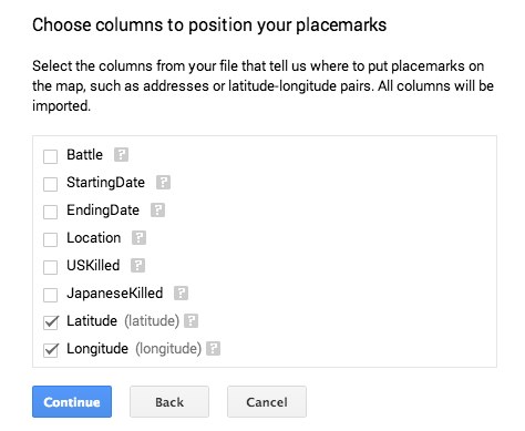
I created the map in Google’s Map Engline Lite first, to make sure it could work and I understood the required steps. Then I coached Sarah to do it on her own, independently, using a Chromebook. When she chose to import her spreadsheet of data, Map Engine Lite immediately recognized the geo coordinates:
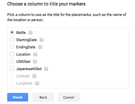
Next, we specified the column to use for the title of each point: The Battle.
After that, it was DONE! Map Engine Lite rocks!
Later this week, Sarah has agreed to record a short screencast narrating the explanation she is going to share in class tomorrow about her GeoMap project, what the data means, and what she learned.
Yes, this project has multiple “Common Core Standards” in it. That’s why I call my digital literacy framework, “Mapping Media to the Common Core!” It just so happens this time, however, the student project actually involves a REAL map!
Would you guess geography was one of my majors as an undergrad?! I love geography, history and social studies, and especially the way geo-map projects can permit us to overlay all three together… just like they do in the “real world” outside of school!
Long live intellectual quests to understand complex issues and events. May those journeys bring us wisdom to avoid the mistakes of the past, and both sensitivity as well as kindness to help heal the scars which persist to this day.
Technorati Tags: geomap, geo-map, map, engine, geography, history, nagasaki, hiroshima


Comments
2 responses to “8th Grade GeoMap Project For English: Road to Hiroshima”
What a cool project!